|
|
|
 |
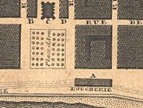
Maps from the Library of Congress and the University of Alabama that can be viewed and some saved: |
Note: All of these maps can be viewed online. The 1815, 1845, 1860, and 1878 maps can be downloaded and saved. |
|
| 1815 Plan of the city and suburbs of New Orleans: from an actual survey made in 1815 by I. Tanesse; Rollinson, sc. New York: Charles Del Vecchio; New Orleans: P. Maspero, 1817. http://hdl.loc.gov/loc.gmd/g4014n.ct000684 1845 Norman's plan of New Orleans & environs, 1845 New Orleans: B.M. Norman, 1845. http://hdl.loc.gov/loc.gmd/g4014n.ct000243 1860 Plan of New Orleans [Philadelphia: S. A. Mitchell], 1860 http://alabamamaps.ua.edu/historicalmaps/us_states/louisiana/NewOrleans.htm Note: Scroll down to S. Augustus Mitchell’s Plan of New Orleans, 1860. A 618k jpg image of this map can be viewed or downloaded here. 1878 Topographical and drainage map of New Orleans and surroundings... S.l.: s.n., T. S. Hardee, 1878 http://alabamamaps.ua.edu/historicalmaps/us_states/louisiana/NewOrleans.htm Note: Scroll down to T. S. Hardee’s Topographical and drainage map of New Orleans and surroundings..., 1878. Click on Plugin to view the map. The entire map cannot be downloaded from this site, but enlarged portions can be saved as jpg files. 1884 New Orleans Chicago: George F. Cram, 1898; from Cram's Universal Atlas, Geographical, Astronomical and Historical, 1898 http://alabamamaps.ua.edu/historicalmaps/us_states/louisiana/NewOrleans.htm Note: Scroll down to George F. Cram’s map, New Orleans, 1898. Click on Plugin to view the map. The entire map cannot be downloaded from this site, but enlarged portions can be saved as jpg files. 1901 The Picayune's map of New Orleans New Orleans: The Picayune, 1901 http://alabamamaps.ua.edu/historicalmaps/us_states/louisiana/NewOrleans.htm Note: Scroll down to The Picayune's map of New Orleans, 1901. Click on Plugin to view the map. The entire map cannot be downloaded from this site, but enlarged portions can be saved as jpg files. 1908 New Orleans: Hammonds complete map of New Orleans New York: C. S. Hammond and Co., 1908 http://alabamamaps.ua.edu/historicalmaps/us_states/louisiana/NewOrleans.htm Note: Scroll down to C. S. Hammond and Co.’s Hammonds complete map of New Orleans, 1908. Click on Plugin to view the map. The entire map cannot be downloaded from this site, but enlarged portions can be saved as jpg files. 1912 Rand McNally New Commercial Atlas Map of New Orleans Chicago: Rand McNally & Co., 1912; from Rand McNally's Commercial Atlas of America http://alabamamaps.ua.edu/historicalmaps/us_states/louisiana/NewOrleans.htm Note: Scroll down to the Rand McNally New Commercial Atlas Map of New Orleans, 1912. Click on Plugin to view the map. The entire map cannot be downloaded from this site, but enlarged portions can be saved as jpg files. |
|
|
|
|