|
|
|
 |
Maps from the David Rumsey Map Collection that can be exported as JPGs of various sizes: |
Note: To find maps of New Orleans, search on the keywords “New Orleans Louisiana.” There are many maps related to Louisiana, New Orleans, and the surrounding area. Maps can be downloaded in the JPG format in various sizes. Go to the "Export" tab above each map to save the file. The David Rumsey Map Collection is here: https://www.davidrumsey.com/ |
|
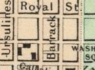
| 1838 Washington. Louisville and Jeffersonville. New Orleans. Cincinnati. Boston: Thomas G. Bradford, 1838 https://www.davidrumsey.com/luna/servlet/s/m95tto Note: The New Orleans map takes up the lower left hand quarter of this atlas page. 1856 The City Of Louisville Kentucky. (with) The City Of New Orleans, Louisiana New York: J. H. Colton, 1856. https://www.davidrumsey.com/luna/servlet/s/d4a6al Note: The New Orleans map takes up the lower half of this atlas page. A 1,701 kb jpg image of this map can be viewed or downloaded here. 1885 New Orleans (La.): Atlas Map Chicago: Rand McNally and Company, 1897. https://www.davidrumsey.com/luna/servlet/s/yjuyty Return to opening page |
|
|
|
|