|
|
|
 |
Sanborn Fire Insurance Maps (aka Sanborn Maps) |
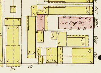
Sanborn Fire Insurance Maps are detailed maps of U.S. cities and towns in the 19th and 20th centuries. The maps were created to allow fire insurance companies to asses their liability in urbanized areas of the United States. The maps are no longer used for underwriting purposes, but are a valuable source of historical information, documenting changes in urban geography. |
|
|
Information on the Library of Congress collection of Sanborn Maps can be found here: https://www.loc.gov/collections/sanborn-maps/about-this-collection/ This page also includes an explanation of the keys and colors used on the maps. Especially important for New Orleans are the 1885-1893 maps, vols. 1-4, because they use the "old" street numbering system (prior to 1893-1894). Sanborn Map Company, 1885; Vol. 1 An 1885-1893 address can be compared to a post 1894 map, which will show the later address, which may be the current address (if the structure still exists). An address in the 1883 Robinson Atlas can also be compared to later maps. Good maps to compare to are the 1895-1896 maps. Sanborn Map Company, 1896; Vol. 1 Volumes one and two of the 1876 New Orleans
Sanborn Fire Insurance maps (the only known copies) are held by Tulane
University. See: Later maps of New Orleans are available online from the
Library of Congress. See a list here. https://nolacityarchives.org/property-research/property-guide-maps-surveys-photos/sanborn-maps/ |
|
|
|
|